
While some map layers, such as the base map, seldom change, additional map layers, such as road furniture (e.g. traffic signs), or lane information change more often. This report sought to understand the rate of change/error vs ground truth data:
Key findings:
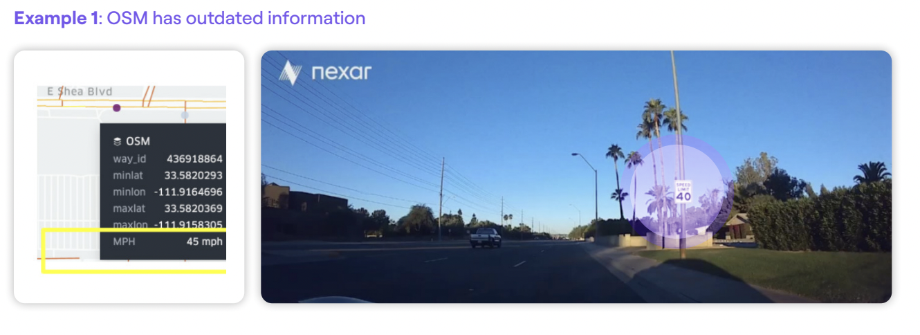
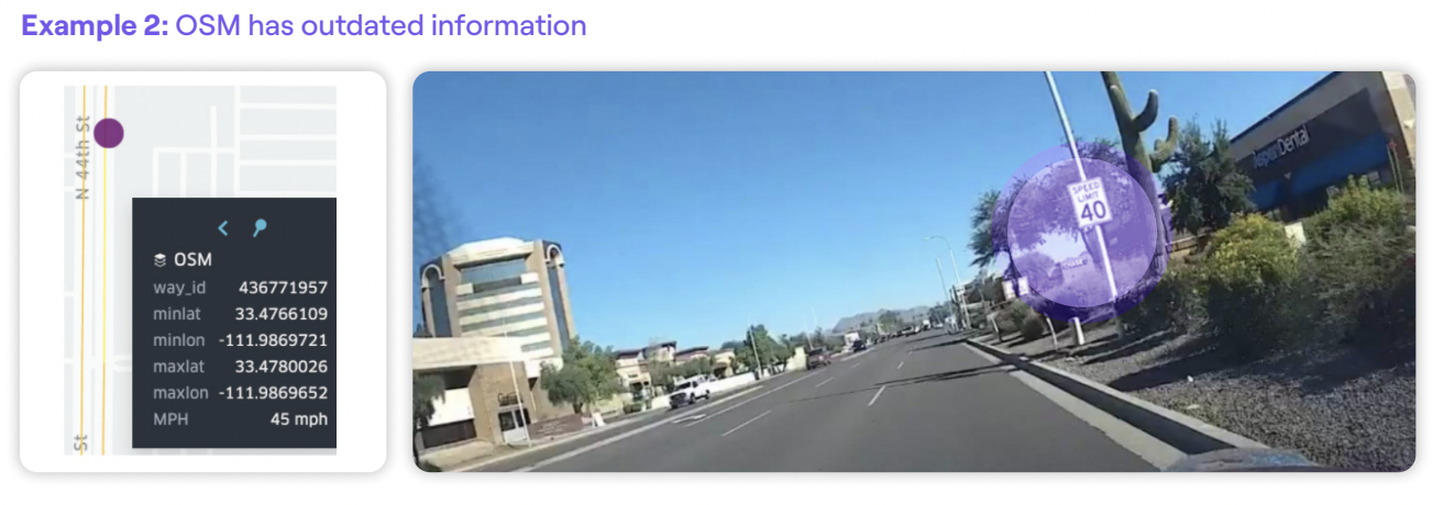
- Comparing our Phoenix, AZ ground truth data with both City of Phoenix and OSM speed limit data shows an error rate of 3-6%, meaning that speed limits posted in streets are not what appear in map data.
- This may be due to changes that happened after the data was inserted into the map, or errors in map creation, and correlates with our findings in Las Vegas, NV, based on Nexar’s vision network and change detection capabilities, the annual rate of street sign change is 2.5%.
- In the case of OSM, 47% of speed limits didn’t appear at all, pointing to a lack of coverage that may also exist with traditional map players.
- Crowdsourcing vision data to “see” ground truth speed limits - as an additional layer on a map, made for driver assist and AVs - is feasible, scalable and useful to ensure map accuracy and change detection.
- Assuming the speed limit layer for driver assist and AVs needs to be 99.5% or higher, as with many automotive applications, AV maps should be updated more often. Using the Las Vegas Nexar numbers shows that updating a map just once a year would only result in 97.5% accuracy.